-
Title
-
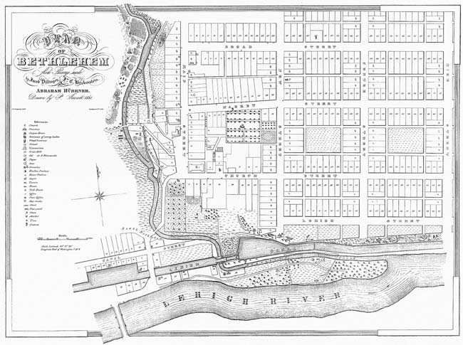
Plan of Bethlehem
-
Alternative Title
-
"Plan of Bethlehem" from surveys made by Jacob Dillinger Esq, Rev. John C. Brickenstein Lot plan of Bethlehem, Pennsylvania north of the Lehigh River
-
Creator
-
Dillinger, Jacob, surveyor
Brickenstein, John C., surveyor
Jarrett, P. , illustrator
-
Publisher
-
Bethlehem Digital History Project
-
Date
-
1841
-
Type
-
Still image
-
Format
-
image/jpg, 24" x 30" (60.9 cm x 76.2 cm)
-
Description
-
Lithographic print
-
Subject
-
Land use surveys--Pennsylvania--Bethlehem
Lithographs--1800-1850
Bethlehem (Pa.)
Maps
-
Identifier
-
DP - f.078.f.078.1
-
Place
-
Bethlehem, Pennsylvania
-
Extent
-
1 sheet; 24" x 30" (60.9 cm x 76.2 cm)
-
Rights Holder
-
Moravian Archives, Bethlehem, Pennsylvania
 1841 Bethlehem Survey