-
Title
-
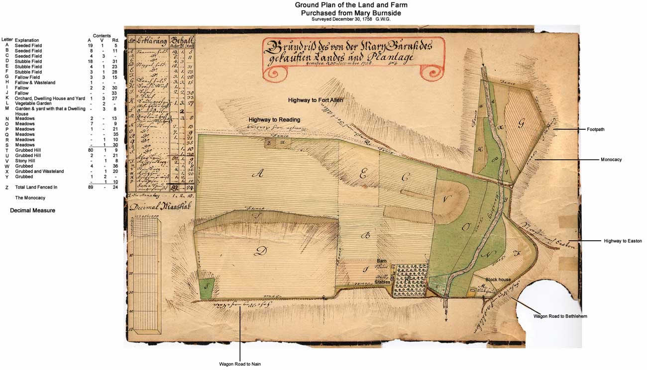
Map of the land and plantation purchased from Mary Burnside
-
Alternative Title
-
"Grundriss des von der Mary Burnsides gekauften Landes und Plantage"
-
Creator
-
Golkowsky, Georg Wenzeslaus, 1725-1813, surveyor
-
translator
-
Schwarz, Ralph
-
Publisher
-
Bethlehem Digital History Project
-
Date
-
1758
-
Type
-
Still image
-
Format
-
image/jpg
Ink and watercolor on paper; 9" x 13" (230 mm x 325 mm)
-
Description
-
Ink and watercolor illustration of the ground plan of Burnside Plantation, prepared by Moravian surveyor, Georg Wenzeslaus Golkowsky in 1758.
-
Subject
-
Plantations
Maps
-
Identifier
-
dr.1.f.2.1
-
Place
-
Bethlehem, Pennsylvania
-
Language
-
German
-
Extent
-
1 sheet
-
Rights Holder
-
Moravian Archives, Bethlehem, Pennsylvania