-
Title
-
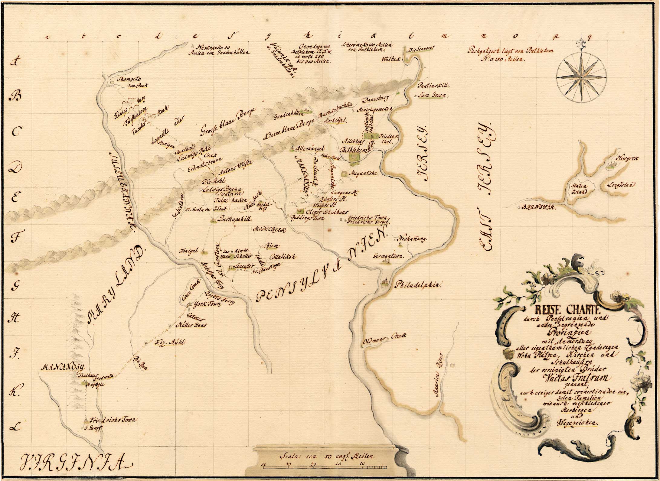
"Reise Charte durch Pennsylvania und ander angraenzende Provinzen"
-
Alternative Title
-
Travel map of Pennsylvania, northern Maryland and New Jersey
-
Publisher
-
Bethlehem Digital History Project
-
Date
-
1750?
-
Type
-
Still image
-
Format
-
image/jpg
Ink and watercolor on linen backed paper; 10 1/4" x 14 1/4" (260 mm x 360 mm
-
Description
-
Cartographic material of Pennsylvania, northern Maryland and New Jersey, constructed with ink and watercolor on linen backed paper, and created c.1750. Scale is 1 inch to twenty english miles.
-
Subject
-
Pennsylvania--Maps--Early works to 1800
Maryland--Maps--Early works to 1800
New Jersey--Maps--Early works to 1800
-
Identifier
-
f.037.6
-
Place
-
Bethlehem, Pennsylvania
-
Language
-
German
-
Extent
-
1 sheet
-
Rights Holder
-
Moravian Archives, Bethlehem, Pennsylvania
-
translation of
-
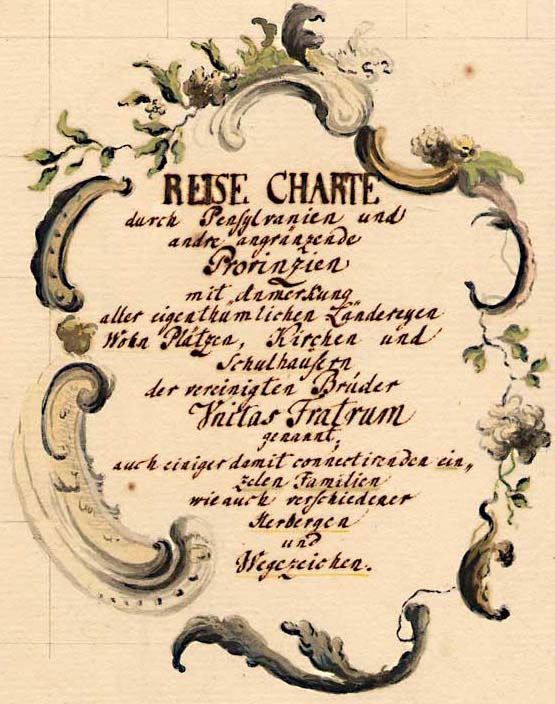
Translation of inset German text: TRAVEL MAP through Pennsylvania and other Bordering Provinces with Notation of all the Estates Living Places, and Churches, and Schoolhouses of the Unified Brethren, known as the UNITAS FRATRUM also some individual families connected to them, as well as various Inns and Roadways.