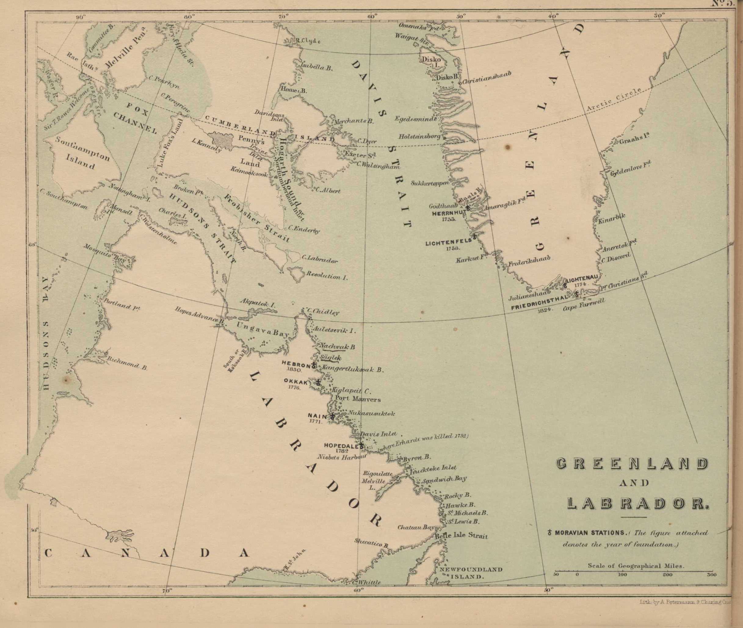
The Moravian Atlas: Map of Greenland and Labrador
Item
-
Alternative Title
-
Map of Greenland and Labrador
-
Creator
-
Compiled by the teachers of the Fulneck Academy
-
Type
-
Still image
-
Format
-
Image/jpg
-
Description
-
Plate number 5 from The Moravian Atlas digitized by the Bethlehem Digital History Project.
-
Subject
-
Moravian Church--Missions--Greenland--Maps
Moravian Church--Missions--Labrador (N.L.)--Maps
Moravian Church--Statistics
Atlases
See all items with this value
-
Source
-
The Moravian Atlas, 1853
-
Identifier
-
Plate_number_5
-
Language
-
English
-
Extent
-
1 map
-
Rights
-
This material is the property of the archives at Reeves Library of Moravian University and the library has elected to place the item in an internet repository as an exercise of fair use for non-commercial educational use. This material may be used for non-profit educational purposes only. Questions about this material and its use may be sent to the Library Director at libref@moravian.libanswers.com.

 MoravianBookScan_6.jpg